View Item
- xmlui.general.dspace_homeCentros e Institutos de InvestigaciónCIRN. Centro de Investigaciones de Recursos NaturalesInstituto de SuelosArtículos científicosxmlui.ArtifactBrowser.ItemViewer.trail
- DSpace Home
- Centros e Institutos de Investigación
- CIRN. Centro de Investigaciones de Recursos Naturales
- Instituto de Suelos
- Artículos científicos
- View Item
¿Cómo afecta el uso de la tierra a las emisiones de oxido nitroso del suelo en el Chaco Subhúmedo? Estudio preliminar
Abstract
La agricultura es responsable de parte importante de las emisiones de óxido nitroso antropogénico que es liberado a la atmósfera desde el suelo. Existe una vacancia de información para la región del Chaco Subhúmedo que permita valorar y comparar las emisiones de óxido nitroso bajo distintos usos de la tierra. Los objetivos del trabajo fueron: 1- Cuantificar en tres fechas de muestreo las emisiones de óxido nitroso bajo diferentes usos de suelo (monte
[ver mas...]
La agricultura es responsable de parte importante de las emisiones de óxido nitroso antropogénico que es liberado a la atmósfera desde el suelo. Existe una vacancia de información para la región del Chaco Subhúmedo que permita valorar y comparar las emisiones de óxido nitroso bajo distintos usos de la tierra. Los objetivos del trabajo fueron: 1- Cuantificar en tres fechas de muestreo las emisiones de óxido nitroso bajo diferentes usos de suelo (monte nativo-cortinas, pastura, lotes agrícolas con soja en
centro-menor compactación- y en cabecera -mayor compactación) y 2- Determinar cuáles fueron las variables edáficas que mejor explicaron la variabilidad de las emisiones medidas. Se seleccionaron 3 sitios de cada una de las situaciones que representan los usos de la tierra más comunes en la región: monte, situaciones bajo cultivo de soja en cabecera (mayor compactación) y centro de lote (menor compactación) y pasturas de Panicum maximun cv. Gatton Panic. La extracción de gas se realizó en tres momentos: 3/2016, 4/2016 y 8/2016 y se extrajeron muestras de suelo de los primeros 10 cm para determinar densidad aparente (DAP), carbono orgánico total (COT), carbono orgánico particulado (COP), nitratos y espacio poroso lleno con agua (EPLLA). Para los lotes agrícolas tanto en cabecera como centro de lote las emisiones fueron bajas en los dos primeros muestreos (1,1 – 2,3 ugN-N2O m-2h-1), en agosto los valores fueron negativos (-3,5 ugN-N2O m-2h-1). En las pasturas la emisión fue alta al inicio (20 ugN-N2O m-2h-1) y final del muestreo (12 ugN-N2O m-2h-1), en abril la tasa de emisión fue similar a la de los lotes agrícolas (1,6 ugN-N2O m-2h-1). El monte presentó el flujo de N2O más alto durante todo el periodo 13 ugN-N2O m-2h-1en marzo, 10,5 ugN-N2O m-2h-1en abril y 20,2 ugN-N2O m-2h-1en agosto. Hubo una relación positiva entre el flujo de N2O y los contenidos de nitratos, COP y COT. La mayor parte de la variabilidad en el flujo de N2O fue explicada por una relación cuadrática con los nitratos del suelo (R2=0,43; P< 0,001). Las propiedades físicas (EPLLA y DAP) no presentaron correlación con la tasa de emisión.
[Cerrar]
Agriculture is responsible of a significant part of the anthropogenic nitrous oxide emissions that are released into the atmosphere from the soil. There is a lack of information on N2O emissions for different regions of the world that allow the assessment and comparison of emissions under different land uses. – The objectives were: 1-Quantify in three sampling dates the emissions of nitrous oxide under different land uses and 2- Determine the soil and
[ver mas...]
Agriculture is responsible of a significant part of the anthropogenic nitrous oxide emissions that are released into the atmosphere from the soil. There is a lack of information on N2O emissions for different regions of the world that allow the assessment and comparison of emissions under different land uses. – The objectives were: 1-Quantify in three sampling dates the emissions of nitrous oxide under different land uses and 2- Determine the soil and environmental variables that best explained the variability of the N2O emissions. Three sites of the most common type of land use in the region: natural forest, soybean crop at the headland (high soil bulk density) and center of the field (low soil bulk density) and pastures of Panicum maximun cv. Gatton Panic. The gas measurements were carried out in three moments: 3/2016, 4/2016 and 8/2016 and soil samples of the first 10 cm were extracted to determine bulk density (BD), total organic carbon (TOC), particulate organic carbon (POC), nitrates and water filled pore space (WFPS). For agricultural fields, both at the headland and at the center of the lot, emissions were low in the first two samples (1.1 - 2.3 ugN-N2O m-2h-1), in August the values were negative (-3.5 ugN-N2O m-2h-1). In pastures the emission was high at the first (20 ugN-N2O m-2h-1) and last sampling dates (12 ugN-N2O m-2h-1), in April the emission rate was similar to that of the agricultural fields (1.6 ugN-N2O m-2h-1). The natural forest has the highest N2O flow during the entire period, 13 ugN-N2O m-2h-1in March, 10.5 ugN-N2O m-2h-1in April and 20.2 ugN-N2O m-2h-1in August. There was a positive relationship between the flux of N2O and the contents of nitrates, POC, TOC. Most of the variability of N2O flux was explained quadratic relationship between soil nitrates and N2O emissions (R2= 0.43; P<0.01). The physical properties (WFPS and BD) did not correlate with the emission rates.
[Cerrar]

Author
Osinaga, Natalia Andrea;
Alvarez, Carina Rosa;
Taboada, Miguel Angel;
Fuente
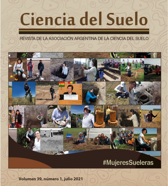
Revista de la Asociación Argentina de la Ciencia del Suelo 39 (1) : 190-201. (2021)
Date
2021-04-09
Editorial
Asociación Argentina de la Ciencia del Suelo
ISSN
1850-2067
Formato
pdf
Tipo de documento
artículo
Palabras Claves
Derechos de acceso
Abierto
 Excepto donde se diga explicitamente, este item se publica bajo la siguiente descripción: Creative Commons Attribution-NonCommercial-ShareAlike 2.5 Unported (CC BY-NC-SA 2.5)


